
Allen Street Directory: Address to Record
An Allen address search works best as a short, repeatable trail. Collin Central Appraisal District, or CCAD, is the first place to locate the appraisal account. The City of Allen parcel layer then supplies map geometry and address fields. The Collin County Clerk index supplies recorded instruments. Each Allen source answers a different question. The appraisal record can point to an owner and account. The map can show which polygon matches the address. A deed can establish a dated transfer. None of those results, standing alone, proves who is presently inside a structure.
- Enter the Allen street number and street name in CCAD legacy property search. Check the returned situs, property ID, geographic ID, legal description, tax year, and owner mailing field.
- Run the same Allen address through the City Tax Parcels layer. Confirm that the selected parcel polygon matches the appraisal account.
- Use the legal description, party name, document type, or document number in the Collin County Clerk land index. Sort results by recorded date before drawing a chain of title.
- For an Allen address with a modern or altered label, compare the subdivision, block, lot, tract, survey, or abstract rather than forcing a street-name match.
- For a dated household lead, consult an archival directory or newspaper volume and retain its publication date and geographic scope. The collection is evidence of a moment, not a current roster.
The Allen voter lookup is not a street tool. It asks for first name, last name, and date of birth, not a street or ZIP. A countywide voter file follows separate request and use rules, so it should not be turned into an Allen street listing.
Allen CCAD Fields by Street
CCAD separates the Allen street number, street name, and suffix. In Allen, its documented pattern is to leave the suffix out of the street-name field and use the separate suffix control. Allen owner names are stored Last First and can use an asterisk wildcard. Property ID is a numeric account identifier, while geographic ID is an alphanumeric parcel identifier that can include optional dashes. The alternate CCAD eSearch also exposes owner, street, subdivision, legal-description, neighborhood, tax-year, and appraisal-event filters.
| Allen CCAD field | How it helps an address search |
|---|---|
| Street number, name, suffix | Locates an Allen appraisal account by its situs components. |
| Property ID and geographic ID | Separates a similar Allen street match from the exact parcel record. |
| Owner name and mailing address | Shows an Allen appraisal association, not assured present occupancy. |
| Subdivision, block, tract, and lot | Bridges an Allen address to a legal description in a deed or plat. |
| Property type, status, and tax year | Provides appraisal context and helps narrow a result. |
Allen CCAD does not publish the oldest online appraisal year on the inspected forms. Treat an Allen negative result as a limit of the current appraisal interface, not proof that the parcel has no prior record.
Allen Road Ranges Resolve Addresses
The City of Allen public roads layer provides road centerlines, road names, and address-range information. That is useful when a suffix, directional, or close street name makes a search uncertain. A centerline describes a road segment, however, not the legal boundary of an Allen parcel. First normalize the house number, directional, street name, and suffix; then compare the address range with the parcel’s actual situs and legal description. This avoids attaching an Allen record to the wrong side of a road or to a nearby subdivision.
Review the City of Allen Roads FeatureServer before treating a similar address as a match.
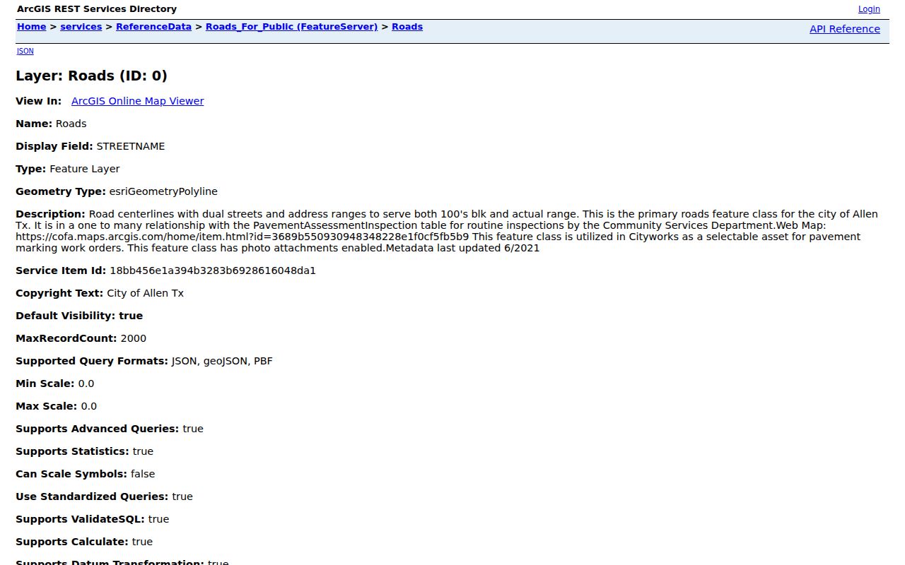
The Allen road display helps normalize a segment and its ranges. It does not identify residents, owners, or a parcel boundary by itself.
Note: An Allen road centerline is map context, so retain the parcel query and source date before relying on an address association.
Allen Parcel Fields and Map Context
The Allen Tax Parcels MapServer is an address and geometry reference service, with identify, query, find, legend, export, and map functions. Its metadata was last updated in May 2025. An Allen parcel result can expose ASITUS_STR and FullAddress for the mapped situs, along with OwnerAddress, OwnerCity, OwnerState, OwnerZip, ParcelOwner, PROP_ID, GEO_ID, Parcel_ID or TylerID, LegalDescription, and CLandUse. Keep the situs and owner-mailing fields separate. A mailing address in another city is normal and does not defeat the Allen parcel match.
| Allen GIS field group | Meaning | Limit |
|---|---|---|
| ASITUS_STR / FullAddress | Mapped street or situs address | A map address is not title proof. |
| OwnerAddress / City / State / ZIP | Appraisal-derived mailing association | May differ from the Allen situs. |
| PROP_ID / GEO_ID / Parcel_ID | Useful join identifiers | Do not assume IDs from separate systems are identical. |
| ParcelOwner / LegalDescription | Mapped owner and legal context | Ownership is not occupancy. |
| CLandUse / geometry / edited date | Allen land-use and map-reference context | The City of Allen says this map is not a legal survey. |
The City of Allen tax-parcel service shows the sort of address, owner, and identifier fields that should be compared before an Allen street result is recorded.
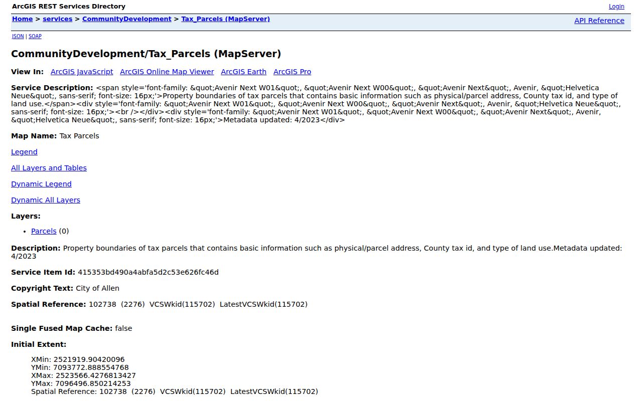
The selected Allen parcel should be checked against its neighboring polygons and its CCAD account. The screenshot is a map-reference view, not a survey or a list of occupants.
Allen Street Directory Record Coverage
Address-keyed Allen sources overlap, but they are not interchangeable. Use the account and map for discovery, then use recorded instruments for a transaction claim. Permit entries can date an activity without naming an occupant. Historical directories can offer a time-stamped address clue only when the particular volume covers Allen or its regional telephone area.
| Allen address source | What it can establish | Access and caution |
|---|---|---|
| CCAD appraisal account | Owner, situs, mailing address, and Allen property and geographic IDs | Public search; current dataset, oldest web year not stated. |
| Allen Tax Parcels GIS | Polygon, parcel fields, legal description, land-use context | Public map/query; reference use, not a survey. |
| County Clerk deeds and plats | Parties, instrument, date, and Allen legal-description, lot, or block details | Public index; copies and certification have fees. |
| Allen road centerlines | Street segment and address-range context | Public FeatureServer; no resident information. |
| Allen permit/public-record search | Address-linked activity and named roles where available | Public portal; a named applicant may not live there. |
| Allen-area directories and newspapers | Dated address or household clues | Coverage varies and must be cited by volume or issue. |
A source label keeps an Allen name hit honest: recorded owner, filing party, permit applicant, or historical directory entry are distinct labels. Do not collapse an Allen result into “resident.”
Allen Legal Descriptions Bridge Addresses
An Allen street number can change after a subdivision, replat, apartment renumbering, or road work, while an older deed may keep a lot-and-block or survey description. No specific Allen street-renumbering project or year was located in the official material reviewed. The safe bridge is the legal description, paired with a historical plat and current parcel geometry. That bridge is more reliable than guessing that two similar address strings refer to the same land.
- Parcel
- A mapped unit of land used for appraisal and GIS reference. One parcel can hold more than one household.
- Situs address
- The property’s physical or mapped address. It can differ from an owner’s mailing address.
- Plat
- A recorded map that lays out subdivision lots, blocks, and related geometry.
- Criss-cross directory
- An address-first directory that can give a dated name clue. No confirmed Allen-specific run was located, so verify the volume’s coverage.
For a full current Allen street chain after the legal-description check, keep CCAD, City GIS, and the Clerk record beside each other. For older directory collection details, use the Allen City Directory rather than treating a catalog listing as an address result.
Allen Deed Index and Certified Copies
The Collin County Clerk index lets an Allen researcher search names as indexed, vary surname and given-name order, use a document number when known, select document type, and sort by recorded date. Compare the legal description back to CCAD before accepting an Allen address match. The portal’s Historical Records route covers 1843 through 1975, a useful connection between early record books and the modern index. For an Allen title or legal conclusion, request a clerk-provided or certified copy instead of relying on an online image.
The Collin County Clerk warns Allen researchers that the online database is not the official repository and that House Bill 4350 redactions can affect recorded information. Online images carry an unofficial watermark. Current fees list named, legal-description, and document-type searches at $10; copies are $1 per page, and certification adds $5 plus the page charge. The Clerk’s property-copy form supports a request when an Allen index result needs an official copy.
Check the Collin County Clerk land-record index for party and document clues before ordering a recorded copy.
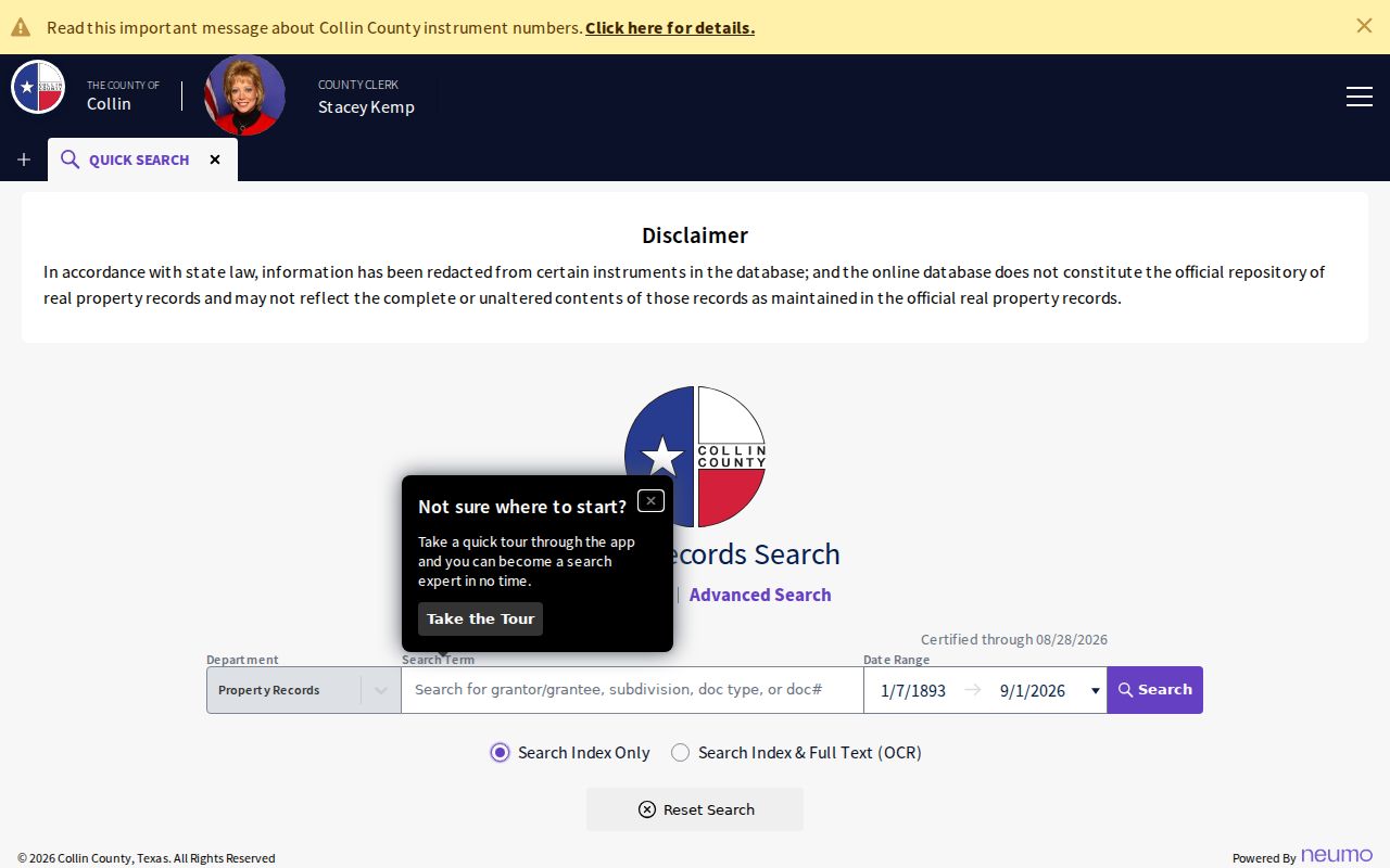
The Clerk search view is a discovery step. Preserve the Allen legal description, recording date, document type, and image status, then use the official copy route when the record must carry legal weight.
Allen Street History Has Gaps
Allen’s address trail spans systems built at different times. The town’s organized history is tied to the Houston & Texas Central Railway arrival in 1872. Later newspapers and telephone directories can capture street clues that never appear in modern appraisal screens. A 1972 Allen American issue, for example, recorded water-meter deposits listing new families and addresses and reported permits for 43 new homes. It is useful dated context, not present-day proof.
Allen may be indexed in McKinney, as a rural route, or in a regional telephone directory depending on the year. Preserve the historic spelling and postal label. Allen growth, new subdivisions, and selective digitization mean a missed web search should lead to an archive or microfilm inquiry, not a fabricated correction.
Allen Street Labels Need ZIP Checks
Allen’s standard postal ZIPs are 75002 and 75013 on the official county map, but a postal label is not a city-limit finding. Nearby ZIPs can appear during an Allen street search, and an owner’s mailing ZIP can be outside Allen. Keep four values distinct when they are available: legal description, parcel situs, owner mailing address, and USPS city and ZIP. City-limit status needs the appropriate municipal or county boundary layer.
Allen CCAD can return OwnerZip, but its inspected forms do not offer ZIP as a street-wide search filter. The Allen voter lookup likewise has no street or ZIP field. Those limits prevent an Allen address result from becoming an Allen ZIP-wide roster.
Note: The official county ZIP map is a geographic reference, not a current boundary-dispute survey.
Allen Permit Searches by Address
The City of Allen Citizen Self-Service portal adds a separate address trail for permits and public records. Choose Search Public Records, select the relevant record type, enter a keyword or address, use the partial-address autocomplete, and open Advanced Search once the address resolves. An Allen permit result can help date work or identify a role connected to an activity. It does not establish who lives at the property, and the oldest public online coverage was not published in the reviewed material.
Use Allen Citizen Self-Service as an address-linked activity source, then keep its record type and search date with the result. A contractor, agent, or applicant is a role label, not a household finding.
Allen Street Record Privacy Boundaries
The Allen street directory should stay limited to lawful, source-based research. Property and deed records can show ownership associations, not every renter, guest, household member, utility customer, or motor-vehicle address. Texas voter protections can suppress sensitive data and protected addresses. The Texas Address Confidentiality Program can substitute a mailing address for eligible people. A blank or substituted result should never be “fixed” by seeking a private address elsewhere.
Lawful use. Allen street and parcel records support personal, lawful research and civic understanding. Do not use an address, map result, or record trail to stalk, harass, intimidate, or harm anyone.
Texas Public Information Act requests for Allen records are governed by Texas Government Code chapter 552 and can be subject to exceptions and redactions. Ask the proper custodian for an existing Allen record with a defined date span and record type.