
Allen Postal Coverage
The official Collin County map identifies 75002 and 75013 as the Allen postal ZIPs. The table keeps those two Allen entries distinct from nearby labels that may show up during a broader search. A postal label can cross municipal lines, and a city name on mail can differ from the incorporated place. Treat the Allen list as postal geography, then use a current parcel and boundary source when the location itself matters.
| ZIP | Areas Covered | Post Office | Notes |
|---|---|---|---|
| 75002 | Allen postal area on the Collin County GIS map | USPS postal bulletin lists Allen, Texas | Allen ZIP; confirm an individual parcel's city status separately |
| 75013 | Allen postal area on the Collin County GIS map | CPU mail center and Allen Station results | Allen ZIP; delivery area and city limit are different tests |
| 75025 | Nearby postal geography on the county map | Not separately inspected as an Allen facility | Do not present as a standard Allen ZIP |
| 75069 and 75074 | Nearby McKinney and Plano postal context | Shown as nearby on the county map | Not Allen ZIPs in the inspected evidence |
| 75173, 75407, 75442 | Broader county oversight reporting | Administrative reporting context only | Not an ordinary Allen postal list |
The county oversight material uses broader city-and-ZIP combinations for reporting, which does not change USPS designation. No official machine-readable neighborhood-by-ZIP table was located for Allen. Do not assign a subdivision to an Allen ZIP from a visual boundary alone.
The county map and the USPS postal bulletin both support 75002 and 75013 as the Allen postal starting points. Neither source supplies a complete street list for either Allen ZIP. A current address still needs a parcel-level check when a record, delivery route, or city-limit question depends on precision.
Allen's Dated ZIP Map
The Collin County GIS ZIP map is dated March 22, 2022 and is based on 2021 aerials and digital city data. Its own notice treats the map as illustrative rather than a legal boundary-dispute survey. It is a useful starting point for Allen postal geography, especially when a nearby ZIP appears in an address history, but it cannot establish a current city line, a delivery route, or an exact neighborhood assignment.
Keep four values apart in Allen research whenever they are available: legal description, parcel situs, owner mailing address, and USPS city and ZIP. A legal situs can be in Allen while the mailing city uses a neighboring postal label. The reverse can also occur, so an Allen mailing label is not by itself proof that the parcel lies inside city limits.
An older Allen directory or deed may preserve the postal label used at the time of the record. Retain that date rather than silently converting the label to a current municipal description.
Note: Recheck a time-sensitive Allen address through current USPS and municipal or county GIS sources before relying on the 2022 map.
Allen ZIP Code Boundaries
ZIP delivery areas, municipal boundaries, county boundaries, school districts, and postal city names are separate systems. For an Allen location question, use a parcel's situs address with an appropriate city-limit layer. Use the postal field to confirm mail routing. The City of Allen parcel service contains a map address, geometry, legal description, and owner mailing fields, while its metadata says the service is not a legal survey.
Nearby 75025, 75069, and 75074 may enter a practical Allen-area search because they appear around the city on the county map. That does not make them standard Allen ZIPs. Likewise, 75173, 75407, and 75442 appear in broad oversight reporting, not in the inspected ordinary Allen postal list. Preserve the source's geographic scope instead of expanding the Allen list from a reporting table.
When an Allen address fails to match a familiar street form, compare the subdivision, lot, block, tract, abstract, or survey description before changing a ZIP or city label. Deeds and plats use those legal descriptions, while postal tools use delivery geography. The two systems can point to the same place without using the same terms.
Allen Postal Service Checks
USPS tools verify postal service and facility information, not residents or municipal status. The USPS location record lists the CPU ZIP Code Mail Center at 2033 W. McDermott Drive, Suite 320, Allen, TX 75013-4675. USPS results also show Allen Station at 401 Century Parkway. Those facilities support a postal-service check for Allen, but a facility location does not define every parcel served by 75013.
The USPS Allen 75013 location record shows the postal-service result used for this check.
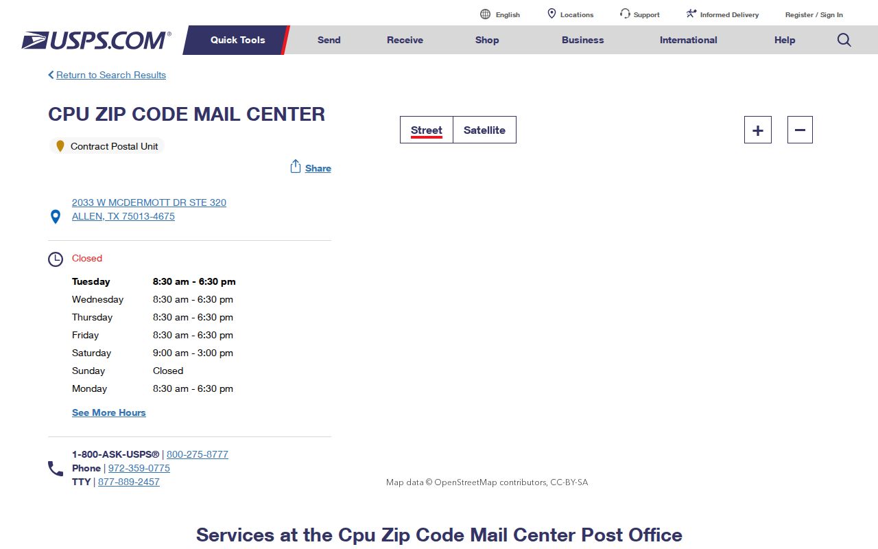
Use the Allen USPS result to confirm a postal route or facility, then return to parcel and boundary data for a city-limit question. USPS does not provide a person search or a list of Allen households.
Allen Parcel ZIP Fields
CCAD is helpful for a known Allen parcel, but it does not offer an inspected ZIP-wide people search. Its forms include city, tax year, subdivision, property type, account status, owner name, street parts, and legal-description choices. The result can return an owner mailing ZIP, yet that is an output field, not a filter for all properties or people in a postal area. Owner ZIP and parcel situs should never be treated as the same field.
| CCAD field or control | Allen research use and limit |
|---|---|
| City | Can narrow a known locality, but it is not a postal-ZIP filter. |
| Tax year | Identifies an appraisal year; it does not establish current occupancy. |
| Subdivision, block, tract, or lot | Helps locate a parcel where an address is incomplete. |
| Owner name | Supports an ownership search with wildcard capability, not a household list. |
| OwnerZip output | Shows mailing data on a result; it is not an Allen ZIP search control. |
The CCAD eSearch form illustrates the property-search controls and locality limits.
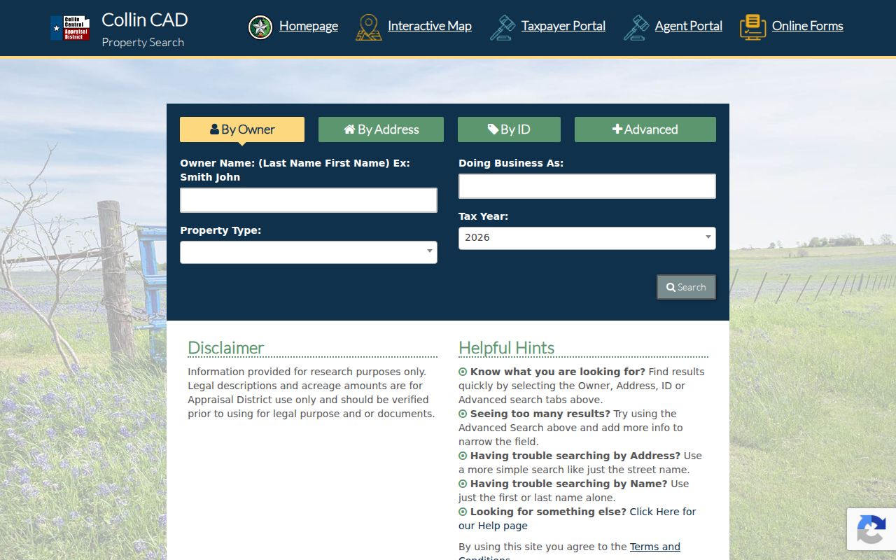
After locating an Allen parcel, retain the CCAD property ID and geographic ID as separate values, then compare them with the City GIS parcel identifiers. A field from one Allen system is not automatically the identifier used by another.
The City parcel layer adds FullAddress, OwnerAddress, OwnerCity, OwnerState, OwnerZip, ParcelOwner, legal description, parcel geometry, and creation or edit dates. Allen map data can help normalize a property search, but an owner mailing address may be outside Allen and does not identify the person at the situs.
Search Allen ZIP Codes
A postal label can organize the first pass, but the official tools do not provide an all-residents-by-ZIP result. Use the workflow below to narrow an Allen address question without turning an output field into a resident list.
- Check the Allen address or facility through USPS to confirm the current postal city and ZIP.
- Open the City of Allen parcel service by address or parcel geometry and record the situs, legal description, property ID, and geographic ID.
- Use CCAD's city, subdivision, or owner and street fields for the known Allen parcel. Do not claim it accepts a ZIP filter.
- For a recorded ownership question, use the legal description or party name in the Collin County Clerk index and distinguish the instrument party from an occupant.
- Once the address is stable, use the Allen street directory for the street-level record trail.
The City parcel layer can be queried for address and geometry, but its public data is map reference material rather than a legal survey. The workflow finds the right property record, not a ZIP-wide list of people.
For an Allen title question, the County Clerk's recorded instrument is the next custodian after a parcel match. Its party names establish a transaction, not the current household.
Allen Voter ZIP Limits
The Collin voter lookup exposes first name, last name, and date of birth for an individual route. It did not expose street or ZIP fields during inspection, and the current page returned an error during unattended review. It cannot be used as an Allen ZIP search. A registration address is regulated information and is not proof of present physical occupancy.
The countywide Election Store is a different process. Its purchased file is not limited to Allen and includes regulated fields; the county prohibits use for advertising or promoting commercial products or services. Protected voters can have nonpublic addresses, and voter history shows election participation rather than a continuous residence or ballot choice.
An Allen voter status marked suspense means the voter remains eligible but may need to confirm or update an address. It is not a finding about a crime, a household, or a present location.
Allen Postal Terms
Postal terms can describe a delivery system without answering a residence question. Use them precisely when comparing an Allen address with property and government records.
- ZIP and ZIP+4
- A five-digit ZIP identifies a delivery area. ZIP+4 adds four digits that narrow delivery sorting, often to a smaller segment or delivery point.
- PO Box ZIP
- A ZIP used for post-office boxes rather than ordinary street delivery. The inspected Allen material did not establish an Allen PO Box-only inventory.
- Unique ZIP
- A ZIP assigned to a single organization or high-volume recipient. The inspected Allen and Collin sources did not establish an Allen unique-ZIP inventory.
- Carrier route
- A mail-delivery grouping used to organize a carrier's work. It is not a municipal boundary or a household roster.
Allen ZIP Research Gaps
No official machine-readable subdivision-by-ZIP table, Allen PO Box-only inventory, or Allen unique-institution inventory was located in the inspected material. Exact subdivision assignments need a current USPS or official GIS check. The City parcel service may give a parcel's situs and IDs, while CCAD may show mailing data, but neither supplies an official all-residents-in-an-Allen-ZIP output.
Historical Allen directories may also use an older postal label. Keep the publication date, source title, and address context with any historical result. Postal geography is a useful filter, but a parcel, court, voter, deed, or directory record still has to be read for its own limited claim.
Allen has no confirmed official ZIP realignment or street-renumbering year in the inspected sources. Leave a mismatch open until an appropriate postal, parcel, or recorded source resolves it.